
Walk a Houma Street by Address
A Houma street directory search works best as a chain of dated records. Ownership is visible through the Terrebonne Parish Assessor and the Clerk of Court, while occupancy must be tested against voter, directory, census, or filed-document evidence. A tax mailing address is not the same as the physical, or situs, address. Likewise, a registered voter match does not account for each person at the address. Keep those roles separate from the first step.
- Enter the physical address in the Terrebonne Parish Assessor search. Save the parcel number, tax year, legal description, owner label, and deed book and page.
- Open the parcel in the Assessor map. Browse the same road with parcel, address, street-centerline, structure, city-limit, and ward layers.
- Check the Louisiana voter address lookup with the full address and ZIP. Treat any match as voter-registration evidence, not a full household roster.
- Follow the book/page or owner name into the Terrebonne Parish Clerk conveyance index. If the paid portal blocks the needed image, request an office search or copy.
- For an older household, ask the Terrebonne Parish Library for the matching directory year, telephone material, census extract, or address-indexed volume.
This sequence creates an address worksheet instead of a loose list of names. Record the original spelling, normalized street name, ZIP, parcel, legal description, record date, and the precise role each person held.
Repeat the same steps for each parcel on the chosen segment. That keeps the scope tied to a named Houma street and prevents a map view from becoming an unsupported claim about the people nearby.
Search Houma Property Address Fields
The Assessor offers more than a single street box. A search can start with parcel number, owner name, property address, section/township/range, subdivision, or legal description. Property address is the plainest route for a modern Houma street. Legal land and subdivision fields matter when an old deed or plat uses no reliable street number.
| Houma Search Mode | Input | Best Use |
|---|---|---|
| Property address | Address number and street name | Find a present physical parcel |
| Parcel number | Parish parcel identifier | Return to an exact assessment record |
| Name | Owner name | Find parcels assessed to that name |
| Section/township/range | Three legal-land fields | Locate rural or old descriptions |
| Subdivision | Autocomplete name | Browse lots within a recorded development |
| Legal description | Text from a deed or assessment | Bridge changed street labels |
The result can show a parcel number, owner label, physical address, mailing address, details link, and tax year. The parcel detail may add ward, values, homestead status, legal description, prior account number, subdivision data, and deed references. Fields differ by parcel.
The official Assessor sample parcel shows how those labels appear on a real detail screen.
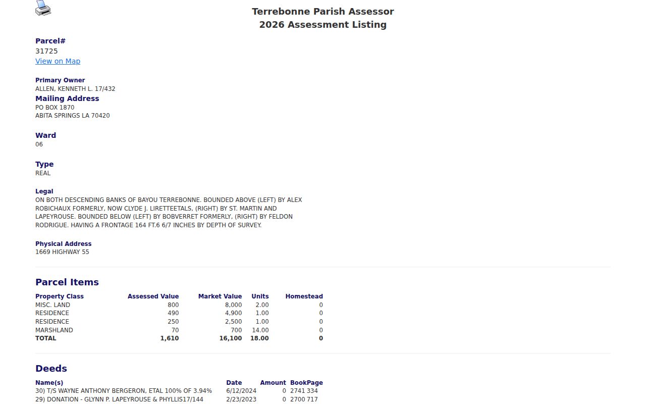
The captured parcel card makes the key distinction visible: physical address, mailing address, assessed owner, and deed references are separate fields with separate meanings.
Browse Houma Street Parcels in GIS
The map turns one parcel result into a street-by-street view. Its physical-address search divides the house number from a street autocomplete. Select Tools can draw lines or polygons, while Neighborhood View and Buffer on Selected Parcel can gather nearby parcel context. The default buffer distance is 200, and units can be changed among feet, miles, kilometers, meters, nautical miles, or degrees.
The Terrebonne Assessor GIS controls show the address, layer, selection, and neighborhood tools used for a Houma street directory search.
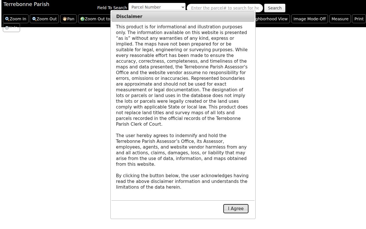
The map can return assessed value, building and land assessment, sale data, square footage, quality class, and parcel number when those fields are selected. It remains a reference map, not a survey or certified list of occupants.
For deeper map context, the TPCG Assessor REST service exposes address, street-centerline, structures, waterbodies, zoning, wards, historic district, annexation, city limit, and parish boundary layers.
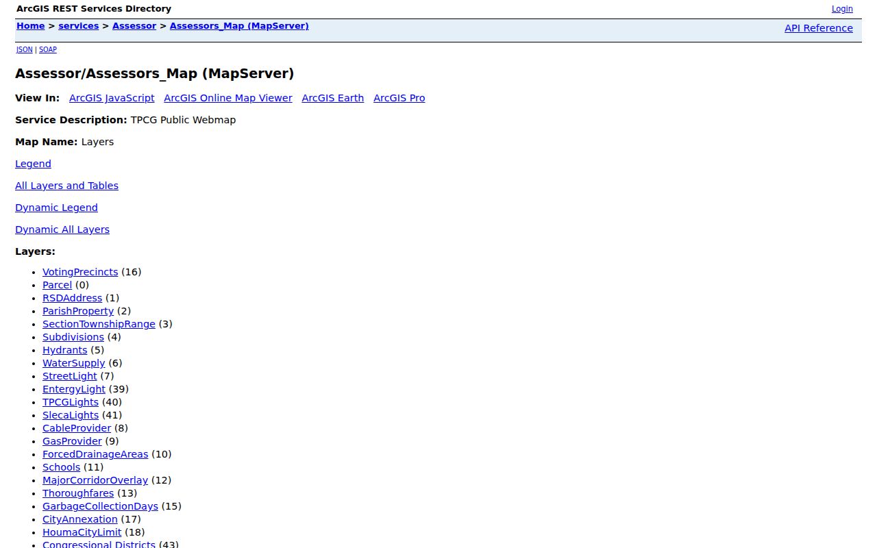
Those layers explain why close parcels may carry different civic or service labels even when both use Houma in a mailing address.
Houma Street Records and Access
Each address-keyed source answers a different question. Use the Assessor and GIS for the parcel, the Clerk for recorded title, the voter system for a dated registration match, and the library for older printed evidence. Houma permit and nuisance material may name a person in a specific role, but neither is a resident roll.
| Record Set | Keeper | What It Shows | Access |
|---|---|---|---|
| Property assessment | Terrebonne Parish Assessor | Owner label, physical and mailing address, values, deed references | Free public search |
| GIS parcel map | TPCG and Assessor | Parcels, structures, streets, wards, zoning, boundaries | Free reference viewer and REST layers |
| Deeds and plats | Terrebonne Parish Clerk | Grantor, grantee, legal description, recorded chain | Subscription, paid name search, office, copies |
| Voter record | Louisiana SOS and parish registrar | Address-based registration match and district context | Public lookup; restricted fields under state law |
| Permits and nuisance files | TPCG departments | Project, complaint, owner, applicant, or violator roles | Office or public-record request fallback |
| Historic directories | Terrebonne Parish Library | Dated names, trades, businesses, streets, residence clues | Open scan for 1897; in-library holdings |
The parcel number and legal description are stronger links than a street label alone. They follow a tract through deeds and plats even when the number changes. Street and ZIP fields then help match voter, permit, postal, and directory evidence to the same place.
Terms in a Houma Address Record
Four labels prevent common mistakes in a Houma street directory search. Read them before deciding what a result proves.
- Parcel
- A locally assigned property record tied to land and assessment data, not to every occupant.
- Situs address
- The physical location of the parcel. It may differ from the owner's mailing address.
- Plat
- A recorded map that identifies subdivisions, blocks, lots, or tracts and helps reconcile changed numbers.
- Criss-cross directory
- An address-ordered directory that leads from a street to a listed name. A separate Houma run has not been confirmed, so ask library staff to inspect each volume.
Always retain the tax year, directory year, filing date, or map access date. The same address can show different names because each source was created for a different task and moment.
Trace Houma Ownership Along Streets
A current Assessor card often supplies the first deed book and page. The Terrebonne Clerk index is subscription-gated, but the office also provides name searches, counter access, regular copies, and certified copies. Conveyances begin in the online certified-date table at the end of 1971, while the Clerk states that office records extend to 1822 or the early 1800s.
Search the current owner as grantee, read the deed, and record the grantor, grantee, date, instrument type, entry or book/page, legal description, and prior reference. Then search the grantor as an earlier grantee. Repeat the method for the next parcel along the block. A deed proves a recorded transfer, not that either party occupied the property.
Online images require the appropriate paid tier. When the index range, login, or image access fails, call the Conveyance/Copy Department at 985-868-5660 or visit 7856 Main Street in Houma with the exact name and legal description.
Note: The online certified date is an index cutoff, while the Clerk's office-held books reach much farther back.
Bridge Old and New Houma Streets
Houma street names are not fixed forever. TPCG renamed duplicate streets in two 2001 ordinances and sent the changes into E911 and agency systems. Billy Street became Hazel Boykin Street effective April 21, 2025. Louisiana R.S. 18:201 also requires a certified old-to-new report to the registrar after an official street rename or renumbering.
Search both forms and preserve the effective date. An old city directory, deed, Sanborn sheet, and modern parcel may all describe the same site with different location keys. The GIS annexation layer adds dated boundary values, but it should be checked against the actual ordinance before drawing a legal conclusion.
Address continuity. The parish documented 55,125 digitized structure addresses in its 2004 master-address, GIS, and E911 work, yet later renames show why historical forms still matter.
Request Houma Files by Address
Permit, planning, condemnation, and nuisance records can add a dated address event. They may identify an applicant, project contact, assessed owner, estate, violator, complainant, inspector, or contractor. None of those labels should be changed into "resident" without a second source.
A complete public result search for the parish's MGO permit system was not located. Use the TPCG office route or submit a Louisiana Public Records Law request with the exact address, record type, department, and date range. Planning and Zoning handles permits, zoning, floodplain, recovery, and nuisance functions from Government Tower, and can help identify the correct custodian.
For an older subdivision question, ask the Clerk about plats. The certified online table starts plats in 2000; older maps may require an office, library, or archive check.
A narrow request tends to work best. Give the custodian the street number, both old and new street names if known, parcel or subdivision details, the record series, and a clear date span. Ask for an index result first when copying a large file would add cost without improving the answer.
Search Houma Streets in Print
The Terrebonne Parish Library states that its genealogy collection holds Houma directories from 1897 to the present, but its web pages do not itemize every year. The open 1897 parish directory includes officers, trades, businesses, streets, plantations, and rural locations. A 1938–39 State Directory Company volume supplies a later city-specific point.
Ask staff whether a selected year has a street index, householder section, telephone book, or other address-ordered material. Do not call the holdings a dedicated criss-cross run unless the volume proves it. Full collection detail belongs in the Houma city directories reference.
OCR can miss short names, initials, and old print. Inspect the page image, title page, abbreviation key, and page heading before recording a name or converting a business location into a residence.
Sanborn maps can add building footprints and block context, while census extracts and obituary indexes can test a name found in print. Each companion source should retain its own date and purpose.
Limits of Houma Street Records
No Houma street directory source provides a complete current household roster. The Assessor identifies assessed ownership, not each person inside. A voter lookup covers registrations that match its required fields and omits people who are not registered. A deed names parties to a legal act. Permit and nuisance files assign procedural roles. Old directories show only what a publisher gathered during that edition.
Utility customer records, DMV address data, protected voter addresses, sealed court or vital files, adoption records, and Address Confidentiality Program information are not ordinary street-search material. Even an open field can be old, misspelled, or tied to a mailing address elsewhere.
Lawful use. Use Houma address records only for lawful personal research, family history, property questions, or civic review. Never use them to stalk, harass, threaten, or harm a person.
When a source conflicts with another, compare dates and obtain the underlying record. The custodian, not a compiled street list, is the final source for a certified fact.